
MAP OF THE MONTH: US Territorial Expansion 1790 – 1861
Armchair General has partnered with The Map as History, a company that produces outstanding animated maps with accompanying narration. Each month, a link to one of their animated maps will be featured on the ACG site.
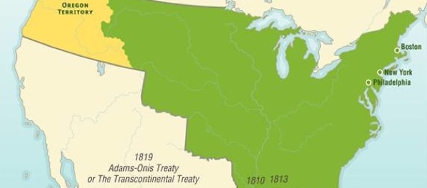
This month’s map explores the United States’ territorial expansion in the years 1790–1861.
Click on the map above to view animation.
{default}To learn more about the growth of the United States of America between 1790 and 1861, click on the titles of online articles below.
Oregon Trail: Wagon Tracks West
It was said that snow did not exist in California’s golden valleys, that the black soil of Oregon was bottomless, that vast rivers afforded easy transportation, and that no forests barred the way to migrating wagons. Ignorance allowed travelers to advance where fuller knowledge might have rooted them with apprehension.
What Do We Owe the Indians?
The Indian Wars of the 19th century were largely fought over land because the federal government refused to uphold its various treaty obligations. The spoils in the 21st-century battles will be natural resources
Missouri Compromise Exposed the Raw Nerve of Slavery
Louisiana had been carved out and accepted as a slave state in 1812, but no other territory had petitioned Congress for statehood out of the purchase lands until Missouri did so in 1818, also wanting to enter the Union as a slave state. That request threatened to unsettle a delicate balance of 11 slave and 11 free states, a balance both sides found necessary for maintaining equal representation in the Senate.
John Jacob Astor: Wealthy Merchant and Fur Trader
Fur became an item of great economic importance to the development of America, but it was politically important as well.