
MAP OF THE MONTH – British Empire Colonial Expansion
Armchair General has partnered with The Map as History, a company that produces outstanding animated maps with accompanying narration. Each month, a link to one of their animated maps will be featured on the ACG site.
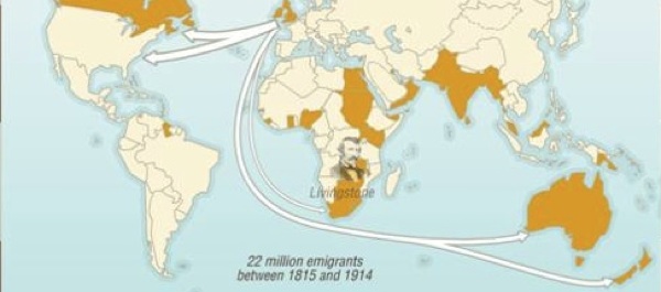
This month’s map explores European Colonial Expansion 1820–1939: British Empire Trading Routes and Construction.
{default}The map shows locations of British colonies in Africa, Asia, the Americas and the Pacific, 1820–1939, and explains why Britain established colonies where it did. Click on the map above to view animation.
Britain’s expansion sparked a number of colonial wars. Suggested online reading:
Sojourning Sacred Ground: Tips on Visiting Isandhlwana and Rorke’s Drift